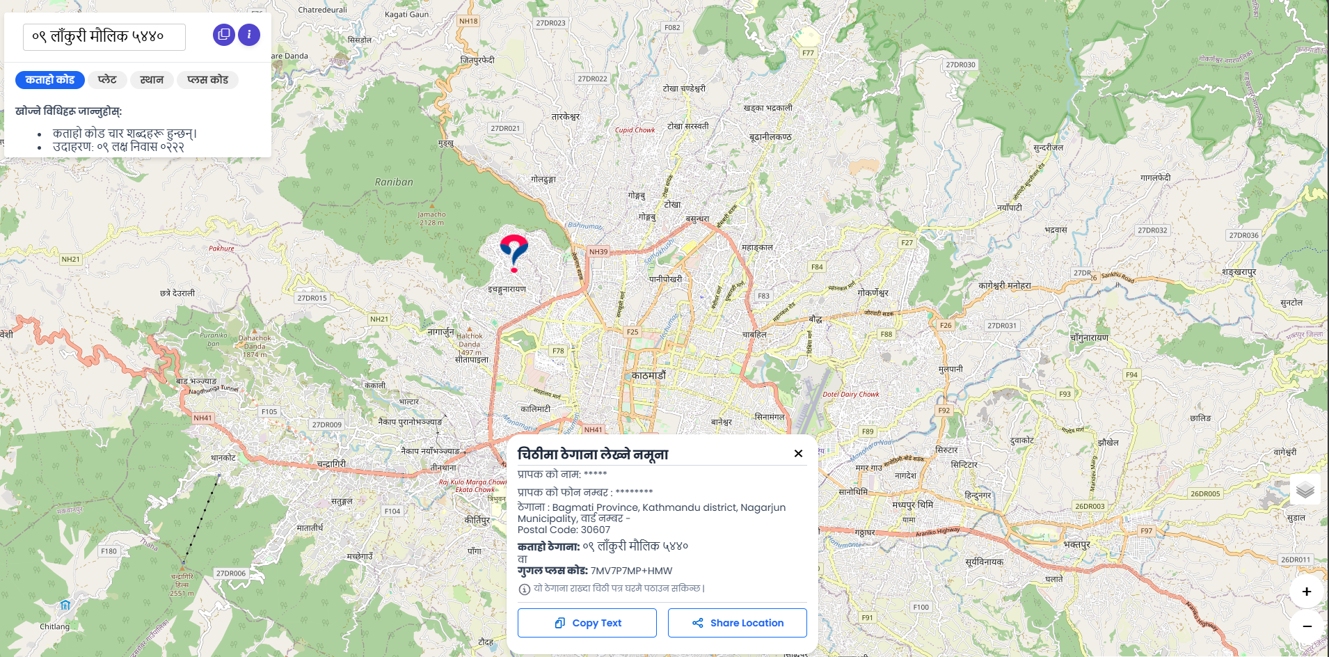
Zipcode Converter Service
Seamlessly convert between geographic coordinates and postal zipcodes across Nepal. Our zipcode converter service provides accurate bidirectional conversion to support address validation, location-based services, and postal operations.
Whether you need to find the zipcode for a specific GPS location or determine the geographic coordinates of a postal code, our service delivers instant and reliable results. Perfect for e-commerce platforms, delivery services, government applications, and any system requiring precise location-to-postal-code mapping.
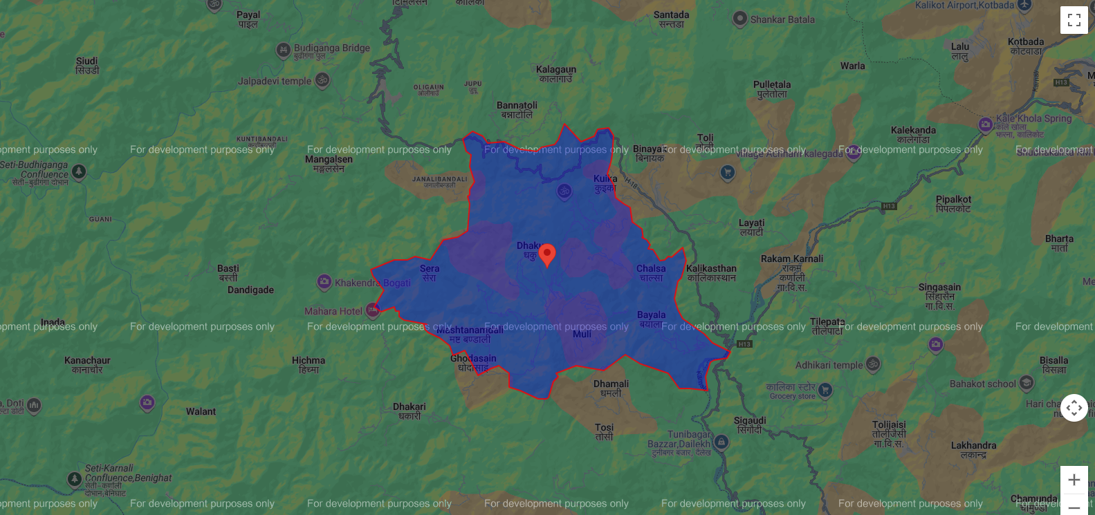
Municipality Boundaries Service
Access detailed boundary information for all municipalities across Nepal. This service provides geographic data for metropolitan cities, sub-metropolitan cities, municipalities, and rural municipalities.
Our municipality boundaries service includes precise GeoJSON data for all local government units, making it easy to integrate municipal-level geographic information into your applications for urban planning, service delivery, and administrative purposes.
Woda (Ward) Boundaries Service
Access the most granular level of administrative boundary data - ward-level information for precise location identification and service delivery across Nepal.
Our ward boundaries service provides comprehensive GeoJSON data for all wards within municipalities. Use this data for hyper-local applications, ward-wise planning, resource allocation, and citizen service delivery. The service also includes point-in-polygon functionality to determine which ward a specific coordinate falls within.